A watershed is an area of land where all the water that falls within it drains to a common outlet, such as a river, bay, or other body of water.
Watersheds collect precipitation and channel it through streams and rivers, eventually reaching the sea.
They play a vital role in managing water resources, supporting ecosystems, and influencing flood risk and water quality.
Understanding watersheds helps us protect our environment and plan for sustainable water use.
Click on each image below to see the full-size in a new tab.
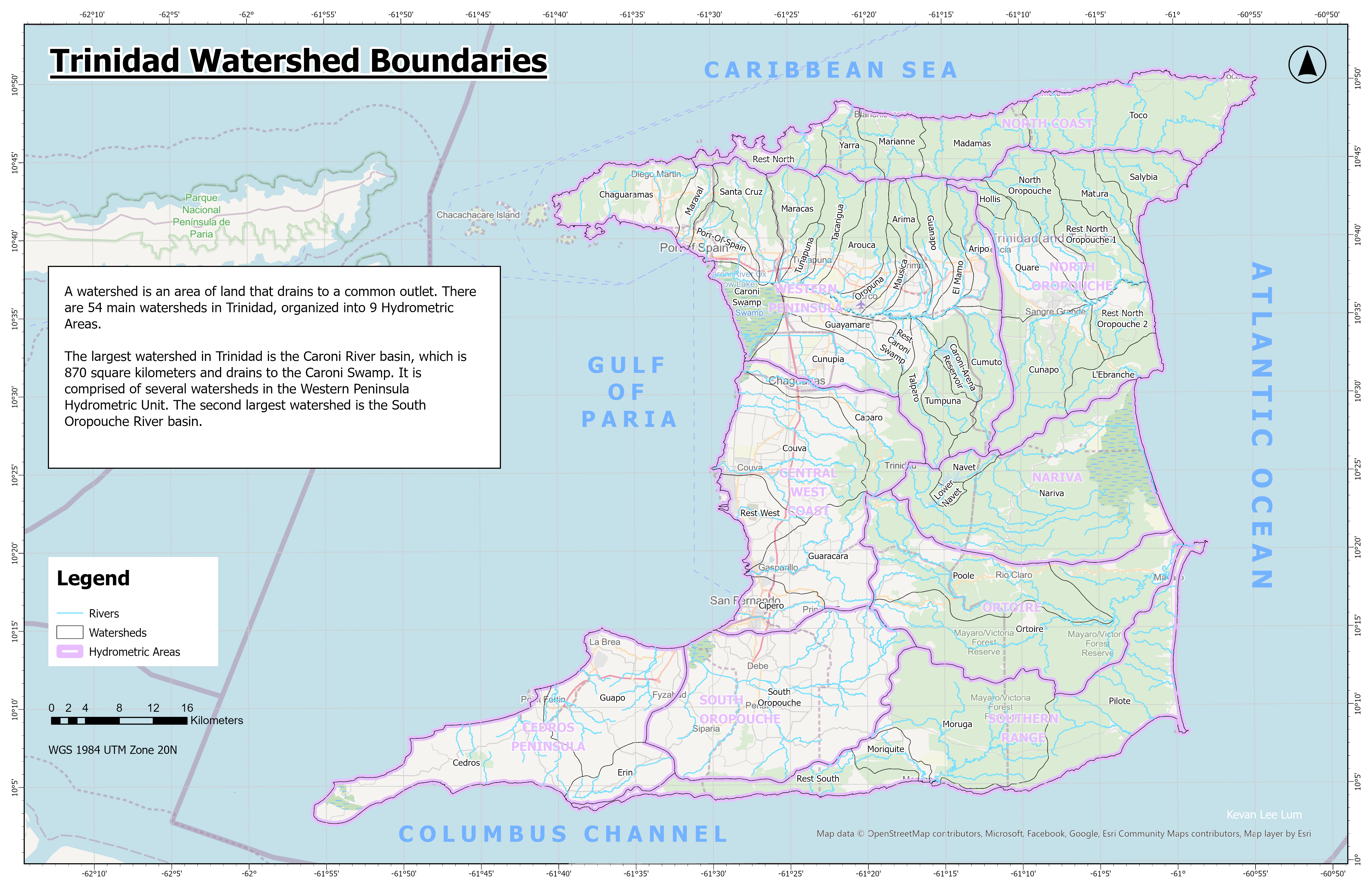
There are 54 main watersheds in Trinidad, organized into 9 Hydrometric Areas.
The largest watershed in Trinidad is the Caroni River basin, which is 870 square kilometers and drains to the Caroni Swamp.
It is comprised of several watersheds in the Western Peninsula Hydrometric Unit.
The second largest watershed is the South Oropouche River basin.
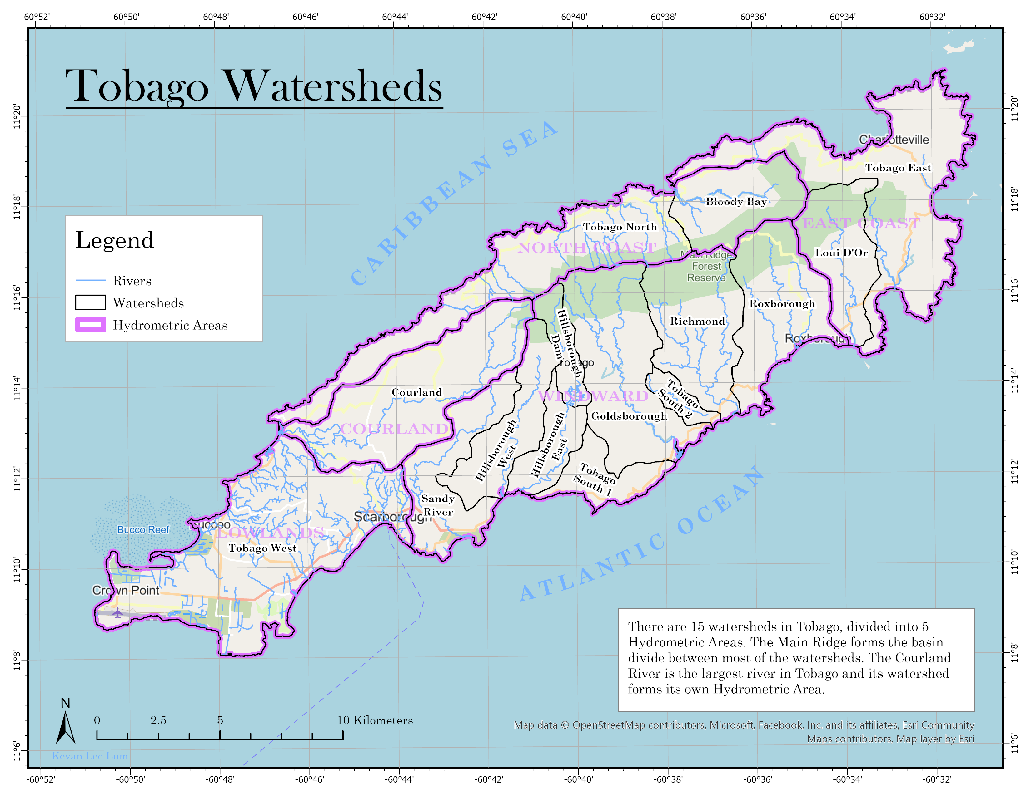
There are 15 watersheds in Tobago, divided into 5 Hydrometric Areas.
The Main Ridge forms the basin divide between most of the watersheds.
The Courland River is the largest river in Tobago and its watershed forms its own Hydrometric Area.
Use the interactive map below to explore the watersheds further.