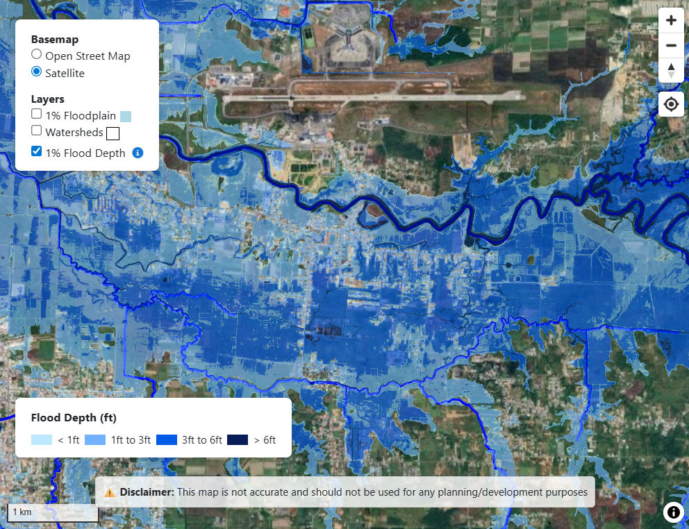
Caroni 1% Flood Hazard Map
Explore the interactive flood hazard map for the Caroni River Basin.
Visualize estimated flood depths for the 1% annual chance (100-year) flood event,
see river networks, and learn about flood risks in Trinidad.
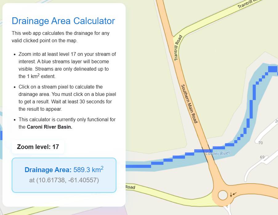
Drainage Area Calculator
Drainage area is an important parameter in most hydrological studies. This web app calculates the drainage for any valid clicked point on the map. It is currently only available for the Caroni River Basin.
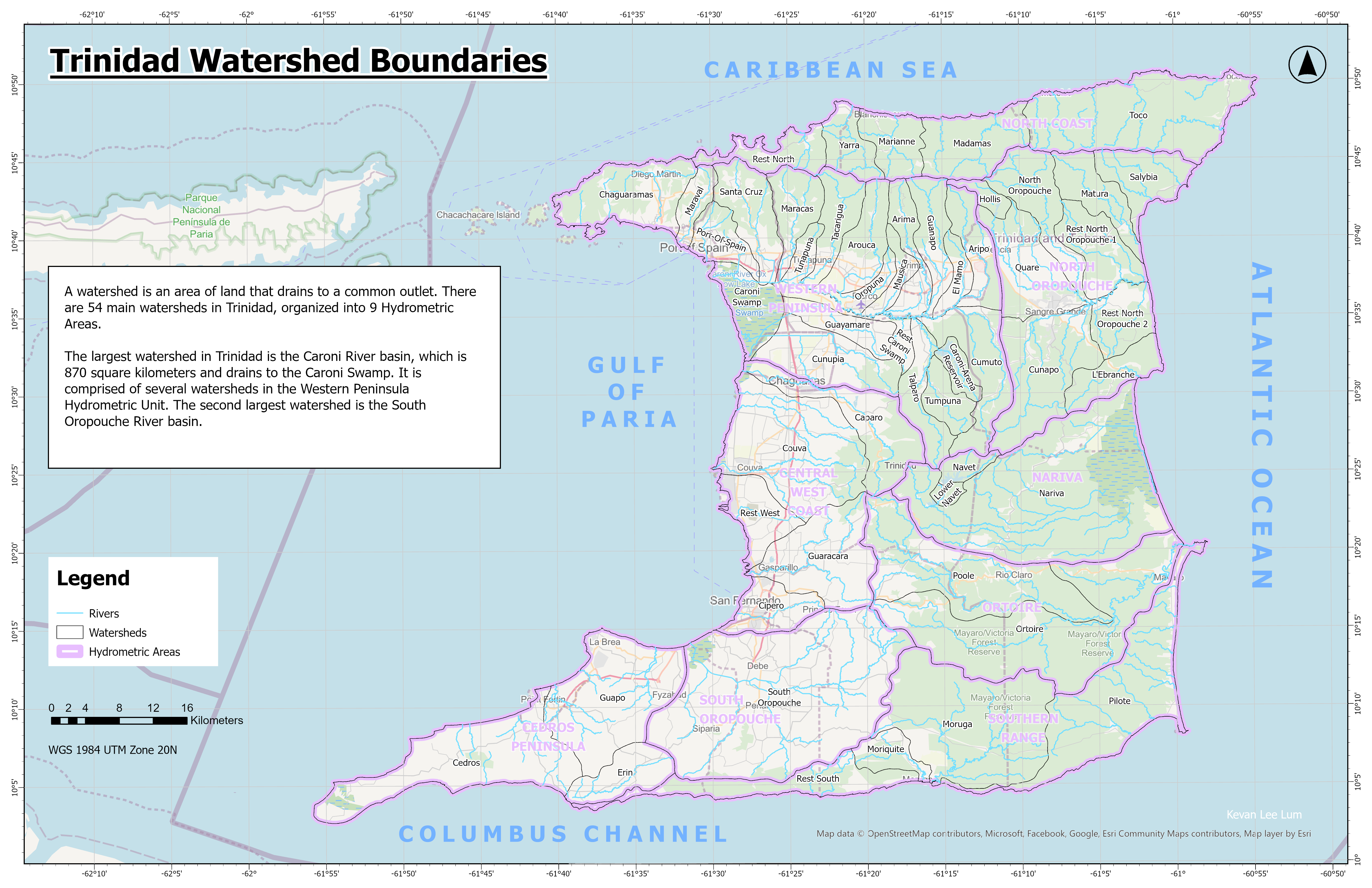
Trinidad & Tobago Watersheds
Browse a static maps of the watersheds of Trinidad and Tobago as well as an interactive map.
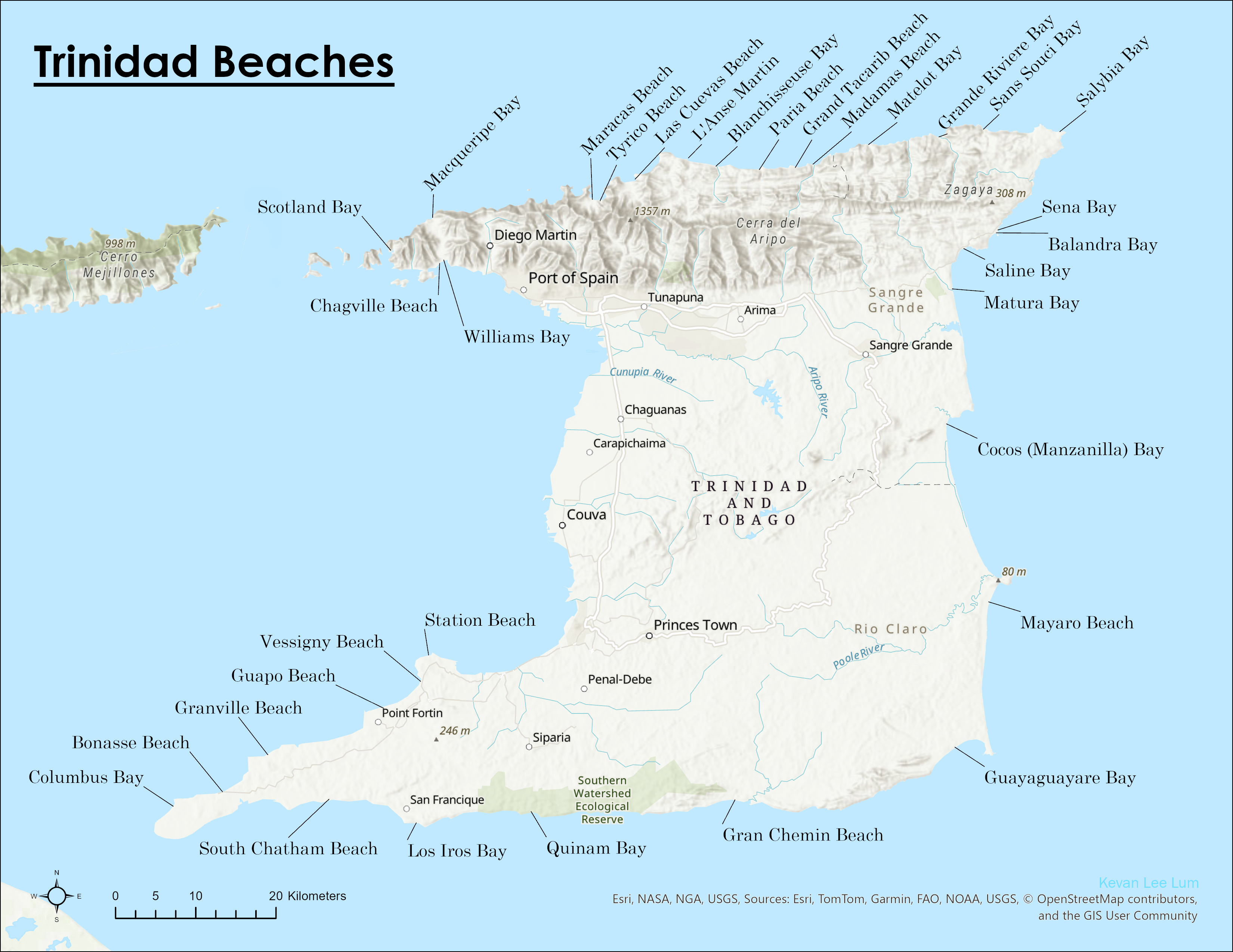
Trinidad & Tobago Beaches
An interactive map of the beaches of Trinidad. Tobago beaches to be added soon hopefully.
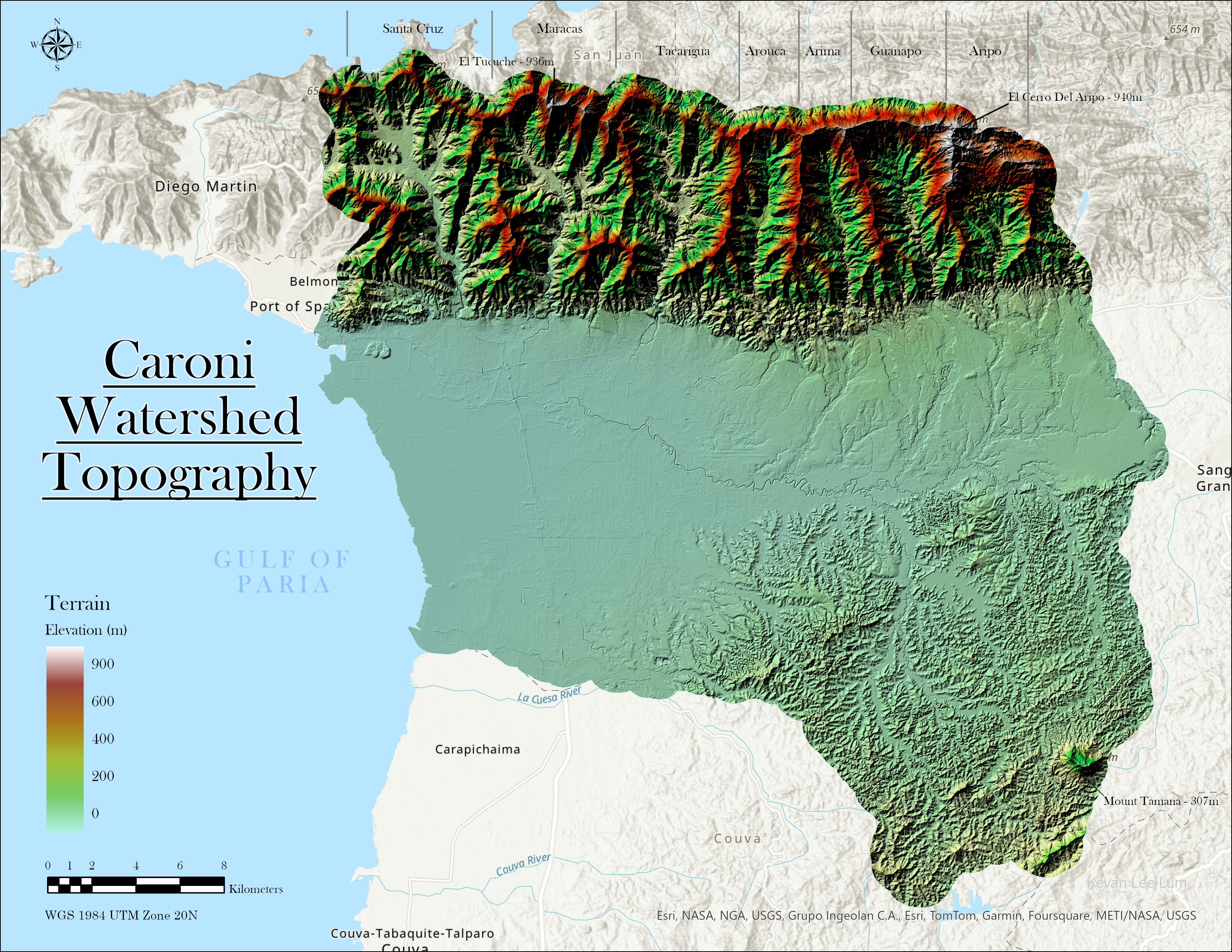
Other Maps of Trinidad & Tobago
Explore a gallery of additional maps of Trinidad and Tobago, including topography, land cover, soils, and more.